Data for this Contest was Contributed by on 2015-10-28
| |
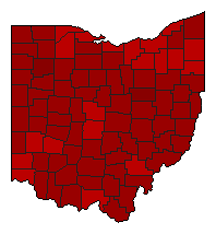
Referendum: Issue 1 (Ohio Constitutional Convention Question) | Popular Vote |
 | No |
3,248,189 |
68.08% |
 | Yes |
1,523,276 |
31.92% |
 |
Map Key
| Turnout
 |  |
|
|
| Election Notes:
- At the general election to be held in the year one thousand nine hundred and thirty-two, and in each twentieth year thereafter, the question: ‘Shall there be a convention to revise, alter, or amend the constitution[,]" shall be submitted to the electors of the state; and in case a majority of the electors, voting for and against the calling of a convention, shall decide in favor of a convention, the General Assembly, at its next session, shall provide, by law, for the election of delegates, and the assembling of such convention, as is provided in the preceding section; but no amendment of this constitution, agreed upon by any convention assembled in pursuance of this article, shall take effect, until the same shall have been submitted to the electors of the state, and adopted by a majority of those voting thereon.
A majority yes vote is necessary for passage.
Shall there be a convention to revise, alter, or amend the constitution?
| Demographic Data
| 2012 Population: | 11,550,971 | Est. | 2012 Population Density: | 108.9 | persons/km2 | | 2010 Population: | 11,536,504 | Enum. | 2010 Population Density: | 108.8 | persons/km2 | | Land Area (2000): | 106,056 | km2 | Annual Pop Growth Rate: | 0.1 | % |
| Election Data and Statistics:
| Election Tools
- Atlas Forum Image Code for Maps: County, Pop
Data Sources:
- Source for Popular Vote data: Ohio Secretary of State. Official Results for 2012 General Election, Ohio Secretary of State (http://www.sos.state.oh.us/sos/upload/elections/2012/gen/FinalResults.xlsx) (accessed 27 Oct 2015)
- Source for Population data: U.S. Census Bureau.
| Results for and Individual County:
| | Primary Documentation:
|
|
| |
|


