


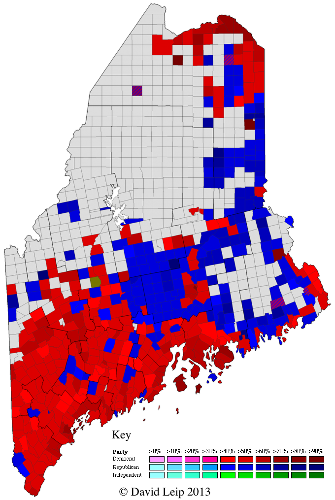
 The 2012 Presidential Election Map by Town for the State of Maine has been added to the Atlas (at right – click for a larger image). The results for Maine are a challenge to map because the Maine Secretary of State lists results for many individual unincorporated townships that the US Census Bureau aggregates into larger geographic regions. For example, the official election results in Washington County include a separate entry for Edmunds Twp (census aggregates into East Central Washington UT), Brookton Twp (census aggregated into North Washington UT), etc. In total, there are 26 unincorporated townships in the 2012 General Election results that are not listed as separate geographic unincorporated townships by the US Census Bureau. To further complicate matters, Maine tends to change which of these townships report from year to year. In 2012, first-time listings include Concord and Spring Lake Twp (Somerset County), Lang Twp (Franklin County), T11 R4, T12 R13, T15 R6, T15 R9, TD R2 (Aroostook County), T7 SD (Hancock County). E Twp in Aroostook County made its first appearance since 1988. Township 14 (Washington County) did not make an appearance in the 2012 Election Results – although its possible that this is actually the entry “Cooper Twps” listed in the Maine Official Election Results. There are a total of 24 entries of vote results that are not associated with a town (such as “Mattawamkeag Twps” – in this case, the results for this entry are from voters in unincorporated townships that have elections administered by Mattawamkeag). Actual geographic origin of these votes in these 24 unincorporated township groupings is under investigation.
To facilitate faster generation of Maine Township Maps for elections, significant effort has been expended to create a database that is relevant to the posted election results. The map above is the first of these to be created based on this new database. It includes all the census county subdivisions plus all the unincorporated townships split out as defined by the State of Maine – resulting in a beautiful map. FIPS codes for these non-census townships are created by the Atlas in a manner consistent with the census numbering (no existing FIPS codes exist for these townships). More Maine maps to be added in the coming days.
Pingback: The New Republic - Nate Cohn
Pingback: New Republic Article on Maine 2012 | The Atlas Weblog