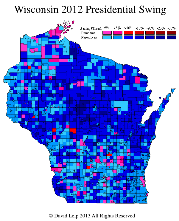
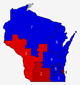
An interesting map to have a look at is the Presidential Swing map by city and town for the state of Wisconsin in the 2012 general election. With Congressman Paul Ryan on as the Republican Vice Presidential candidates – a native representing Wisconsin’s first congressional district, does the map reflect a larger vote swing in his home district? The second map at right shows the 2012 Presidential Election Results by U.S. Congressional District. The first district is located in the southeast corner of the state – south and west of Milwaukee. The overall result in the first congressional district was Romney/Ryan 51.6%, Obama/Biden 47.4%, Others 1.1%. However, the swing map shows that the cities and towns within the first district are about average for the southern half of the state. Larger swings towards the Romney/Ryan ticket were recorded in the northern portion of the state, especially within the seventh and eighth districts. More detail on this can be viewed on the 2012 Wisconsin Presidential Election Results by City and Town page.
Login


