| |
Gubernatorial
Candidate | Lt. Gubernatorial
Candidate | Political
Party | Popular Vote |
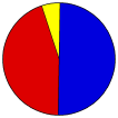
 | Mitt Romney | Kerry Healey | Republican |
1,091,988 |
49.77% |
 | Shannon O'Brien | Christopher Gabrieli | Democratic |
985,981 |
44.94% |
 | Jill Stein | Anthoney Lorenzen | MA Green |
76,530 |
3.49% |
| Carla Howell | Richard Aucoin | Libertarian |
23,044 |
1.05% |
| Barbara Johnson | Schebel | Independent |
15,335 |
0.70% |
| | | |
1,301 |
0.06% |
 |
Map Key
| Turnout
 |  |
|
|
| Demographic Data
| 2010 Population: | 6,547,629 | Enum. | 2010 Population Density: | 322.4 | persons/km2 | | 2002 Population: | 6,417,206 | Est. | 2002 Population Density: | 316.0 | persons/km2 | | 2000 Population: | 6,349,097 | Enum. | 2000 Population Density: | 312.7 | persons/km2 | | Land Area (2000): | 20,306 | km2 | Annual Pop Growth Rate: | 0.3 | % |
| Election Data and Statistics:
| Election Tools
- Atlas Forum Image Code for Maps: County, Town, Pop, Tnd, Swg
Data Sources:
- Source for Popular Vote data: Massachusetts Secretary of the Commonwealth. Elections Division, pub., "Governor," Public Document #43 Massachusetts Election Statistics 2002 (Boston, 2003)
- Source for Population data: U.S. Census Bureau.
| Results for and Individual County:
|
|
| |


