1924 Secretary of State General Election Results - Utah
Note: The Google advertisement links below may advocate political positions that this site does not endorse.
Data for this Contest was Contributed by on 2016-12-09

  Secretary of State
Candidate
Political
Party
Popular Vote
H. E. CrockettRepublican 80,918 54.88%
James W. FunkDemocratic 66,522 45.12%
State Seal Map Key
 > 50%
 > 60%
 > 70%
 > 80%
Turnout
Voter Turnout Graph
Vote Pie Chart
Maps
  1924 Utah County Map of General Election Results for Secretary of State  
County Button
Per Vote Republican Button
Per Vote Democratic Button
 
Demographic Data

1930 Population:507,847Enum.1930 Population Density:2.4persons/km2
1920 Population:449,396Enum.1920 Population Density:2.1persons/km2
Land Area (2000):212,751km2Annual Pop Growth Rate:1.2%

Election Data and Statistics:
  • County Data (Table) (m)
  • County Data (Graphs) (m)
Election Tools
Data Sources:
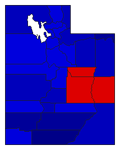
  • Source for Popular Vote data: Utah Secretary of State. Abstract of the Returns of an Election Held in the State of Utah, Tuesday, November 4th, A.D. 1924, Utah Secretary of State (http://uselectionatlas.org/DOC/UT/UTCanvass1924.pdf) (accessed 21 Jul 2016)
  • Source for Population data: U.S. Census Bureau.
Results for and Individual County:
  • (m)


Beaver County Box Elder County Cache County Carbon County Daggett County Davis County Duchesne County Emery County Garfield County Grand County Iron County Juab County Kane County Millard County Morgan County Piute County Rich County Salt Lake County San Juan County Sanpete County Sevier County Summit County Tooele County Uintah County Utah County Wasatch County Washington County Wayne County Weber County