| |
Senatorial
Candidate | Political
Party | Popular Vote |
 | Orrin G. Hatch | Republican |
657,608 |
65.31% |
 | Scott Howell | Democratic |
301,873 |
29.98% |
 | Shaun Lynn McCausland | Constitution |
31,905 |
3.17% |
| Daniel Geery | UT Justice |
8,342 |
0.83% |
| Bill Barron | Unaffiliated |
7,172 |
0.71% |
| JoAnn Secrist | Write-in |
1 |
0.00% |
 |
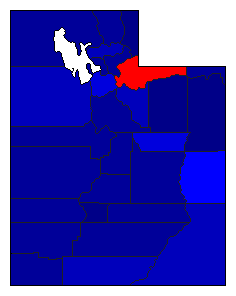
Map Key
| > 40% |
 |
 |
| > 50% |
 |
 |
| > 60% |
|
 |
| > 70% |
|
 |
| > 80% |
|
 |
| Turnout
 |  |
|
|
| Demographic Data
| 2012 Population: | 2,854,146 | Est. | 2012 Population Density: | 13.4 | persons/km2 | | 2010 Population: | 2,763,885 | Enum. | 2010 Population Density: | 13.0 | persons/km2 | | Land Area (2000): | 212,751 | km2 | Annual Pop Growth Rate: | 1.6 | % |
| Election Data and Statistics:
| Election Tools
- Atlas Forum Image Code for Maps: County, Pop, Tnd, Swg
Data Sources:
- Source for Popular Vote data: Utah State Elections Office. 2012 General Election Canvass Report, Utah State Elections Office (http://elections.utah.gov/Media/Default/2012%20Canvass/2012%20General%20Canvass%20Report.xlsx
) (accessed 26 Nov 2012)
- Source for Population data: U.S. Census Bureau.
| Results for and Individual County:
| | Primary Documentation:
|
| The 2012 Campaign:
|
|
| |


