| |
Presidential
Candidate | Vice Presidential
Candidate | Political
Party | Popular Vote | Electoral Vote |
 | Ronald Reagan | George Bush | Republican |
469,105 |
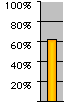
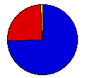
74.50% | 5 |
 | Walter Mondale | Geraldine Ferraro | Democrat |
155,369 |
24.68% | 0 |
 | David Bergland | James Lewis | Libertarian |
2,447 |
0.39% | 0 |
| Delmar Dennis | Traves Brownlee | American |
1,345 |
0.21% | 0 |
| Sonia Johnson | Richard Walton | Citizens |
844 |
0.13% | 0 |
| Dennis Serrette | Nancy Ross | United Ind. All. |
220 |
0.03% | 0 |
| Gus Hall | Angela Davis | Communist |
184 |
0.03% | 0 |
| Melvin Mason | Matilde Zimmerman | Soc. Workers |
142 |
0.02% | 0 |
 |
Map Key
| > 40% |
 |
 |
| > 50% |
|
 |
| > 60% |
|
 |
| > 70% |
|
 |
| > 80% |
|
 |
| Turnout
 |  |  |
|
| Maps | 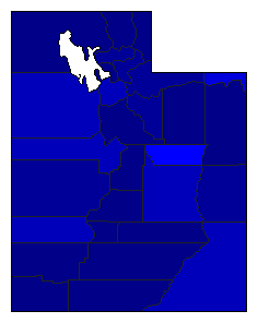 |  |  | | Pop. (m) | | Rep. (m) | | Dem. (m) | | Swg (m) | | Tnd (m) |
| |
| Demographic Data
| 1990 Population: | 1,722,850 | Enum. | 1990 Population Density: | 8.1 | persons/km2 | | 1984 Population: | 1,622,339 | Est. | 1984 Population Density: | 7.6 | persons/km2 | | 1980 Population: | 1,461,037 | Enum. | 1980 Population Density: | 6.9 | persons/km2 | | Total Electoral Vote: | 5 | | Electoral Vote Density: | 324,468 | persons/EV | | Land Area (2000): | 212,751 | km2 | Annual Pop Growth Rate: | 1.7 | % |
| Election Data and Statistics:
| Election Tools
- Atlas Forum Image Code for Maps: County, Pop, Tnd, Swg
Data Sources:
- Source for Popular Vote data: Utah, State of Utah General Election Report November 6, 1984 (Salt Lake City, 1984)
- Source for Population data: U.S. Census Bureau.
| Results for and Individual County:
|
|
| |


